Carto-Cymru Symposiwm Mapiau Cymru 2026: Mapio Byd o Newid | Carto-Cymru The Wales Map Symposium 2026: Mapping a World of Change
Llyfrgell Genedlaethol Cymru a Chomisiwn Brenhinol Henebion Cymru yn cyflwyno,
mewn cydweithrediad gyda Environment Systems
The National Library of Wales and The Royal Commission on the Ancient and Historic Monuments of Wales present, in association with Environment Systems.
Carto-Cymru
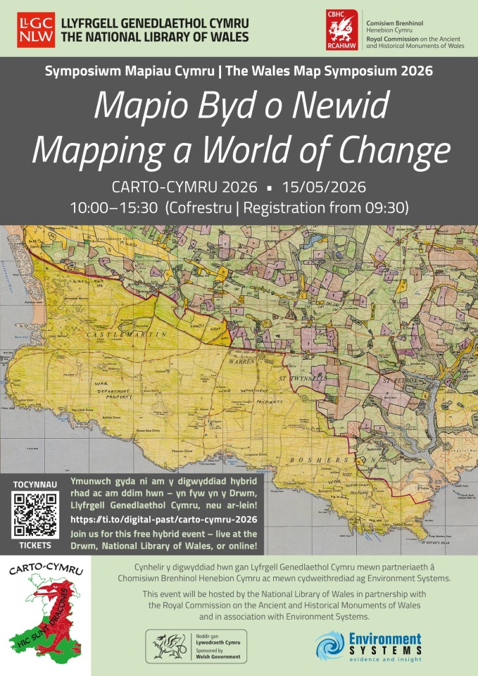
Symposiwm Mapiau Cymru 2026 | The Wales Map Symposium 2026 Mapio Byd o Newid | Mapping a World of Change
15 Mai | May 2026
Thema | Theme:
Mapio Byd o Newid: Archwilio sut mae mapiau yn helpu ni i ddeall yr amgylchedd sy’n newid o’n cwmpas – y gorffennol, presennol a’r dyfodol - a mesur ein traweffaith ar y byd o’n cwmpas.
Mapping a World of Change: Exploring how maps help us understand our changing environment - past, present and future- and measure our impact on the world around us.
Cofrestru: Registration: Bydd cofrestru mewn person yn agor am 9.30am gyda lluniaeth ysgafn ar gael. Bydd y sgyrsiau ar-lein yn cychwyn am 10am. In-person registration will open at 9.30am with refreshments available. The online talks will begin at 10am.
Cyflwyniadau | Presentations:
10.00 Croeso gan | Welcome by Dr. Rhodri Llwyd Morgan, Prif Weithredwr, Llyfrgell Genedlaethol Cymru | Chief Executive, The National Library of Wales.
10.10 Geocyfeirnodi Mapiau Clostiroedd Cymru | Georeferencing the Welsh Enclosure Maps – Freya Canham & Bethan Evans, Cynorthwywyr Geogyfeirnodi, Comisiwn Brenhinol Henebion Cymru | Georeferencing Assistants, Royal Commission on the Ancient and Historical Monuments of Wales.
Bydd y sgwrs yma’n cael ei chyflwyno yn y Gymraeg a’r Saesneg gyda chyfieithu ar y pryd mewn Saesneg.
This talk will be given in Welsh and English with simultaneous translation in English.
10.50 Using historic maps and artificial intelligence (AI) to identify areas of ancient woodland in Wales –
Evie Brown and John Cook, Data Science Unit, Digital Data and Technology, Welsh Government.
11.30 Mapping the world around us: environmental mapping in the National Map Collection – Huw Thomas, Curadur Cynorthwyol Mapiau, Llyfrgell Genedlaethol Cymru | Assistant Curator of Maps, The National Library of Wales
12.15 Cinio. Cyfranogwyr i wneud trefniadau eu hunain - bydd caffi Pen Dinas ar agor. |
Lunch. Delegates to make their own arrangements - Pen Dinas café will be open.
Yn ystod cinio, fe’ch gwahoddir i weld arddangosfeydd a dynnwyd o archifau’r Comisiwn Brenhinol a’r Llyfrgell Genedlaethol. Bydd y rhain yn cael eu harddangos yn Ystafell Ddarllen a Chwilio CBHC ac Ystafell Summers y Llyfrgell Genedlaethol, a byddant yn cynnwys casgliadau cartograffig a ffotograffig dethol, gyda phwyslais arbennig ar ffotograffau o’r awyr.
During lunch, you are invited to view exhibitions drawn from the archives of the Royal Commission and the National Library. These will be displayed in the RCAHMW Reading and Search Room and the National Library’s Summers Room, and will feature selected cartographic and photographic collections, with particular emphasis on aerial photographs.
14.00 Land Use and Wildscapes of mid-20th Century Britain: Digitising the Second Land Utilisation Survey – Bruce Mitchell, Dadansoddwr Geo-ofodol ac Arolygydd Cartograffeg, Data Pensaernïol, Gweithrediadau a Chynnydd, Swyddfa Ystadegau Gwladol | Geospatial Analyst and Cartography Supervisor, Data Architecture, Data Growth and Operations, Office for National Statistics.
14.40 Environmental mapping: looking backwards, looking forwards – Dr Gemma Bell, Ymgynghorydd Uwch | Senior Consultant, Environment Systems.
15.20 Sylwadau i gloi gan | Closing address by Scott Lloyd, Rheolwr Ymchwil, Comisiwn Brenhinol Henebion Cymru | Research Manager, Royal Commission on the Ancient and Historical Monuments of Wales.
Tickets
Additional Information
For further information E-mail: nicola.roberts@rcahmw.gov.uk Tel: 01970 621248